Description
Garmin GPSMAP 67i
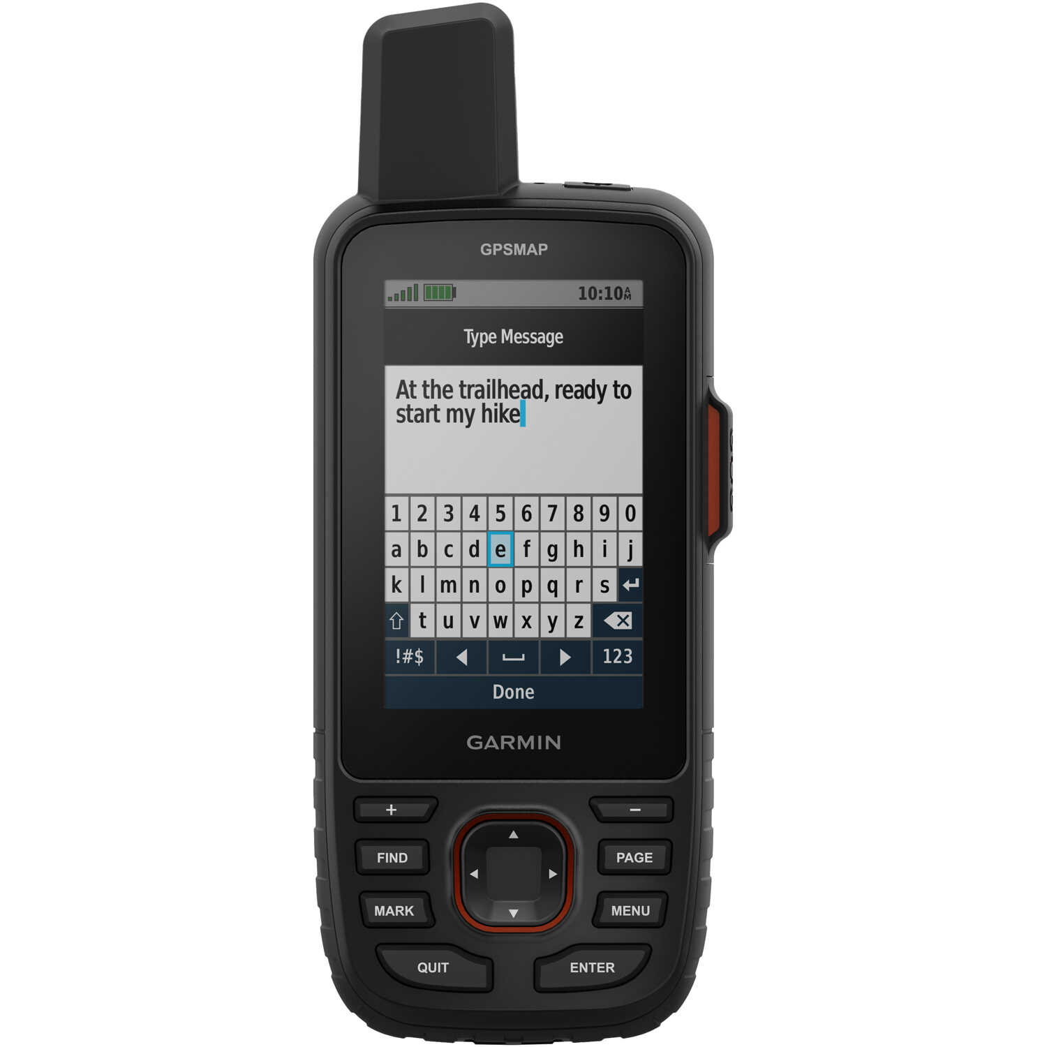
Explore the outdoors and stay on track with the GPSMAP 67i. Multi-band technology and expanded GNSS support deliver superior accuracy even in challenging locations such as steep country, urban canyons, and forests with dense trees. In addition, the GPSMAP 67i uses inReach® technology to enable two-way messaging and location tracking via the 100% global Iridium® satellite network (active subscription required; some jurisdictions regulate or prohibit the use of satellite communications devices). You can even trigger an interactive SOS to Garmin Response℠, a 24/7 staffed emergency response coordination center. This premium, rugged handheld is packed with navigation sensors, routable TopoActive mapping, and access to satellite imagery. Pair it with a compatible smartphone to access active weather forecasts, Geocaching Live, and the Garmin Explore™ app for trip planning and more. The large 3" sunlight-readable color display allows for easy viewing. Includes Type-A to Type-C USB cable, carabiner clip, and documentation.
Warning: Cancer and Reproductive Harm P65Warnings.ca.gov
Have A Question?
Quick Specs
| Brand | Garmin |
| MPN | 010-02812-00 |
| UPC | 753759308636 |
| UNSPSC | 52161518 |
| Other |
Basemap: Yes. Preloaded Maps: Yes (TopoActive, routable). Waypoints: 10,000. Track Log Points: 20,000. Routes/Legs: 250. Waterproof Standard: IPX7. Battery: Rechargeable internal Li-ion. Battery Life: Default Mode, up to 165 hours; Expedition Mode, up to 425 hours. Memory: 16 GB (user space varies based on included mapping). External Memory Storage: Yes (32 GB max microSD™ card). Interface: USB-C. Display Size: 3" diagonal. Dimensions: 6.4"H x 2.5"W x 1.4"D. Weight: 8.1 oz.
|
Quick Specs
Related Products
Shop All Forestry EquipmentHave a question about this product?